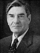

Cortesão became the first Agent-General of the Colonies and founded the Boletim da Agência Geral das Colónias [Bulletin of the General Colonial Agency], which he led until 1932. He wrote several articles on the colonies, geography, cartography and history. During this period, he visited all Portuguese colonies and the capitals of the main European colonial powers, taking part in international forums and exhibitions. In 1928, he joined the International Colonial Institute, remaining a member for 30 years. In 1930, he was awarded the rank of Grand Officer of the Military Order of Christ in recognition of his exceptional contributions to the nation through his public service.
In early 1932, he was removed from his senior positions for political reasons. From then on, he focused on writing his historical research before embarking on a series of conferences on ancient cartography and historical topics, including the Columbian question. As a colonial official, Cortesão was part of a group of scientific and technical personnel who were essential to overseas policies pursued by the Portuguese state in the first half of the 20th century. The political regime was a somewhat secondary issue, as the “ Ultramar ” (Overseas Territories) was seen as a national issue that united various political and ideological positions, from liberal democratic republicanism to the rhetorical nationalism of the Estado Novo.
From an early age, Cortesão was interested in topics related to Portuguese overseas expansion. His first paper, titled Onde era o Cabo dos Mastros dos nossos antigos Navegadores [Where Was the Cape of the Masts of Our Ancient Navigators?], was published in 1926. In 1932, he published an article in Seara Nova about a new atlas by Vaz Dourado, followed later that year by a monographic study in O Instituto on the 16th-century Portuguese cartographer family named Homem. This study became the foundation for his first major work in cartographic studies, Cartografia e cartógrafos portugueses dos séculos XV e XVI [Cartography and Portuguese Cartographers of the 15th and 16th Centuries], published in 1935.
