
................................
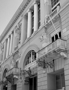
After its initial meetings held in a borrowed room provided by the Medical Sciences Society, the SGL moved to its own premises: between 1876 and 1883, on Rua do Alecrim ; from 1883 to 1891, in a building on Rua Capelo ; from 1891 to 1897, in the Palácio das Chagas ; and, since 1897, in a building owned by the Coliseu dos Recreios Company on Rua das Portas de Santo Antão . These relocations (1876–1897) were driven by the need for additional space to house the growing collections of the SGL, particularly the Museum and the Library, and symbolically reflected the scientific prestige and technical influence the SGL was gradually gaining with the executive authorities.
The SGL aimed to fulfil its duty to both science and the nation by connecting Portugal to the international scientific network, which at the time encompassed numerous institutions and societies. In doing so, it sought to counter external criticism and the negative image associated with the lack of technical and scientific oversight in the country’s colonial policies. Simultaneously, it sought to expand the production and dissemination of knowledge about colonial territories and foster nationalist fervour, in the name of regenerating Portuguese society in accordance with the intellectual norms of the time, rooted in positivism and the scientific paradigm.
Inspired by similar societies already established in major European cities (Paris, 1821; Berlin, 1828; London, 1830; St Petersburg, 1845; Vienna, 1856, etc.), which in turn drew inspiration from the model of the African Society founded in London in 1788, the SGL was established during a period in Europe marked by political stability following the Franco-Prussian War (1871) and an increasing scientific, political, and economic interest in the African continent. At the time of the SGL’s creation, there were approximately forty geographical societies worldwide. The focus on geography arose from its strategic significance, starting in the late 18th century, for political figures within state administrations. The development of physical and natural sciences during the Enlightenment, supported by the experimental method and advances in mathematics, combined with a desire for scientific and technological exploration, encouraged exploratory voyages and archaeological, ethnological, and economic interest in discovered lands. From the early 19th century, the potential for the creation and expansion of new markets in Africa led to governments in countries such as England and France promoting and financing scientific expeditions. Geographical societies created during this period aimed to support these exploratory activities, deriving scientific, political-military, and economic benefits. These exploratory activities grew in complexity throughout the 19th century, with the African continent becoming the primary focus. By the 1870s, expeditions concentrated on the central-southern regions of Africa, including the Niger basin (until 1830), the Zambezi River, Lake Chad, and the Nile’s sources (1830–1856), and later the cross-regional hydrographic networks. These efforts were enhanced by the results of campaigns by European explorers with scientific training, advanced equipment, and institutional, economic, and state support, such as Livingstone (1866–1873), Cameron (1873–1875), Stanley, and Savorgnan de Brazza (1874–1875) in central-southern Africa.
This work is financed by national funds through FCT - Foundation for Science and Technology, I.P, in the scope of the projects UIDB/04311/2020 and UIDP/04311/2020.
