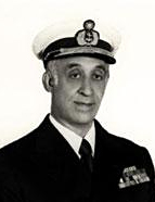

Until that point it was thought that astronomical navigation began in the Atlantic, with the calculation of latitudes, immediately followed by use of nautical charts graduated with latitude-based scales. Teixeira da Mota posed the question in another way. When studying the propositions put forward by António Barbosa and the British historian E.G.R. Taylor, he noticed that there had been a phase that preceded the use of latitudes and was very similar to the way in which pilots navigated the Indian Ocean – a phase in which the Portuguese mariners began by using the difference between the elevations of stars to check their north/south progress and merely used latitudes to give them information about coastlines.
A Viagem de Bartolomeu Dias e as Concepções Geopolíticas de D. João II (1958) – this article appeared in the year in which commemorations were held to mark the 470th anniversary of the rounding of the Cape of Good Hope by Bartolomeu Dias. The study looked at one of the most often referred-to reigns in the history of Portugal – that of King João II (1481-1495). Earlier works founded on interpretations of the chronicles of Rui de Pina, Garcia de Resende and Damião de Góis had praised João II’s policy, associating it with a golden period in the history of the small Portuguese kingdom. These patriotic studies emphasised a number of elements: the monarch’s plans for the Atlantic area; his “Indies project”, which was a means of reaching Asia by sailing round Africa; that the colonies were administered effectively from 1474 onwards; the increase in diplomatic contacts; and the king’s shrewdness, which was thought to be a sign of an authentic Renaissance Prince. However, they lacked a coherent explanation and a sufficiently enlightening overall analysis of the Perfect Prince’s royal wishes – one with the ability to problematise both the geographic "interpretations" that existed at the court and elsewhere in Europe, and João II’s African policy, which was central to his ambitions. Teixeira da Mota wanted to study the monarch’s actions and work, but made it clear from the start that he thought that historians usually made the mistake of putting other leading figures of the day on a pedestal and inappropriately attributing great deeds to them. He instinctively rejected this approach, and says so in this study, in which he looks at the history and not at heroic acts and deeds. It was exactly his experience in Africa and as a brigade officer for the Guinea Geo-Hydrographic Mission that enabled him to analyse João II’s actions in an innovative way. It is also likely that his undoubted cartographic knowledge helped shed new light on the subject. We think that the key lay precisely in the experience and information he acquired on the African continent and in his in-depth knowledge of historical cartography. In short, in this essay on “King João II’s Geopolitical Ideas” we find a new historiographical approach, which was acquired in Africa and enriched during the process of perfecting methods and techniques that incorporated new issues, and which clearly diverged from the currents of the day, which were more inclined to an idea of history based on heroic deeds.
